Skip to content

Backpacking Adventures in my 60s

Still Going Strong

  • Still Going Strong
  • Home
  • Contact

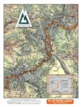
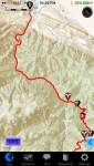
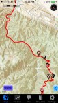
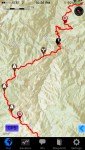
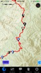
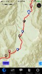
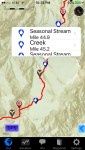
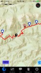
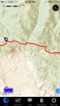
Maps: Colorado Trail

Colorado, USA
Colorado Trail Poster – Then the next few maps show what I was following for my first week…
Day 1 out of Waterton Canyon – Then there are 10 more maps taking me to my first re-supply at Kenosh Pass
#2
#3
#4
#5
#6
#6 (showing water information)
#7
#8
#9
#9 (Showing information)
#10 – Kenosha – first resupply

Share this:

  • Click to share on X (Opens in new window) X
  • Click to share on Facebook (Opens in new window) Facebook
Like Loading...

Photo and Map Galleries by Chapter

Click on the Chapter Name to see more maps and photos (map pages are listed first and then photo pages)

Pages

  • Still Going Strong
  • Maps: Three Tarns Pass ?
  • Maps: Three Tarns Pass – Unfinished Business
  • Maps: The Dusky
  • Maps: Arthurs Pass
  • Maps: The Dragons Teeth
  • Maps: Antarctica
  • Maps: Tasmania
  • Maps: Alaska – Chilkoot Trail
  • Maps: South America
  • Maps: Pyrenees
  • Maps: Pyke Big Bay
  • Maps: Lake Poteriteri
  • Maps: Nepal
  • Maps: Colorado Trail
  • Photos: Three Tarns Pass ?
  • Photos: Three Tarns Pass – Unfinished Business
  • Photos: The Dusky
  • Photos: Arthur’s Pass
  • Photos: The Dragon’s Teeth
  • Photos: Antarctica
  • Photos: Tasmania
  • Photos: Chilkoot Trail
  • Photos: South America
  • Photos: The Pyrenees
  • Photos: Pyke/Big Bay
  • Photos: Lake Poteriteri
  • Photos: Earthquake Zones
  • Photos: Colorado Trail
  • Contact

Recent Posts

  • Welcome to Still Going Strong September 8, 2016
Blog at WordPress.com.
  • Subscribe Subscribed
    • Still Going Strong
    • Already have a WordPress.com account? Log in now.
    • Still Going Strong
    • Subscribe Subscribed
    • Sign up
    • Log in
    • Copy shortlink
    • Report this content
    • View post in Reader
    • Manage subscriptions
    • Collapse this bar
 

Loading Comments...
 

    %d